Future work, traffic plans
The Wadena project will take three construction seasons to complete from June 2025 to August 2027.
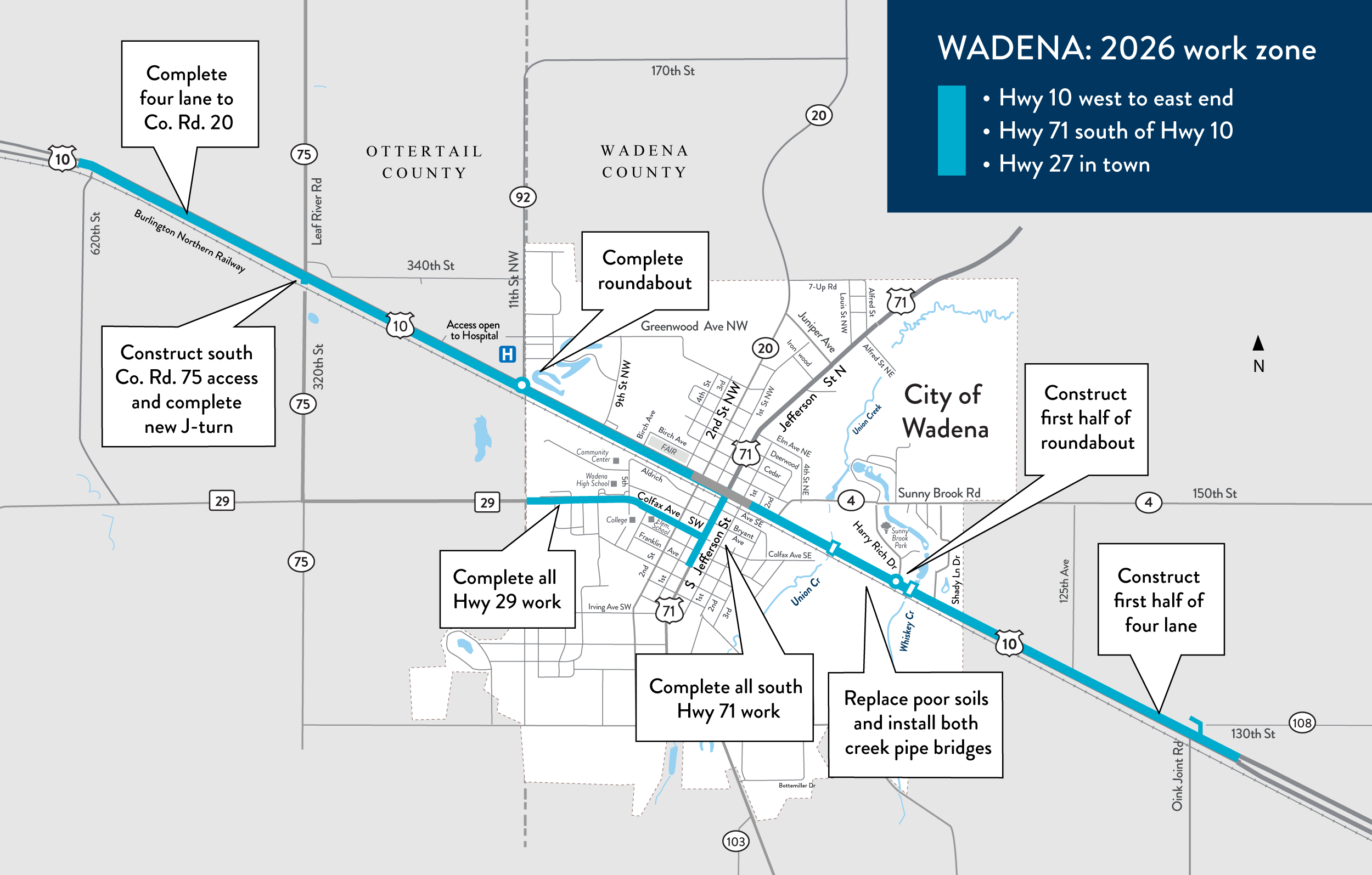
Crews will begin to prepare the 2026 work zone in mid-April along Hwy 10. Like 2025, you can expect a lot of changes as you navigate multiple work zones over the summer. There will be detours, and access to local roads and adjacent connections may change.
Work by year map

MnDOT will improve these areas on Hwy 10, 29 and 71. Select map to enlarge.
Schedule at a glance
All information is tentative and subject to change by contractor or MnDOT.
Dates |
Map color |
Construct |
Impacts |
April-late October 2026 |
Cyan | 2026 work areas map
Hwy 10
Hwy 71 south of Hwy 10
Hwy 29
|
Hwy 10, Hwy 71, Hwy 29 Open one lane each way, except during detours:
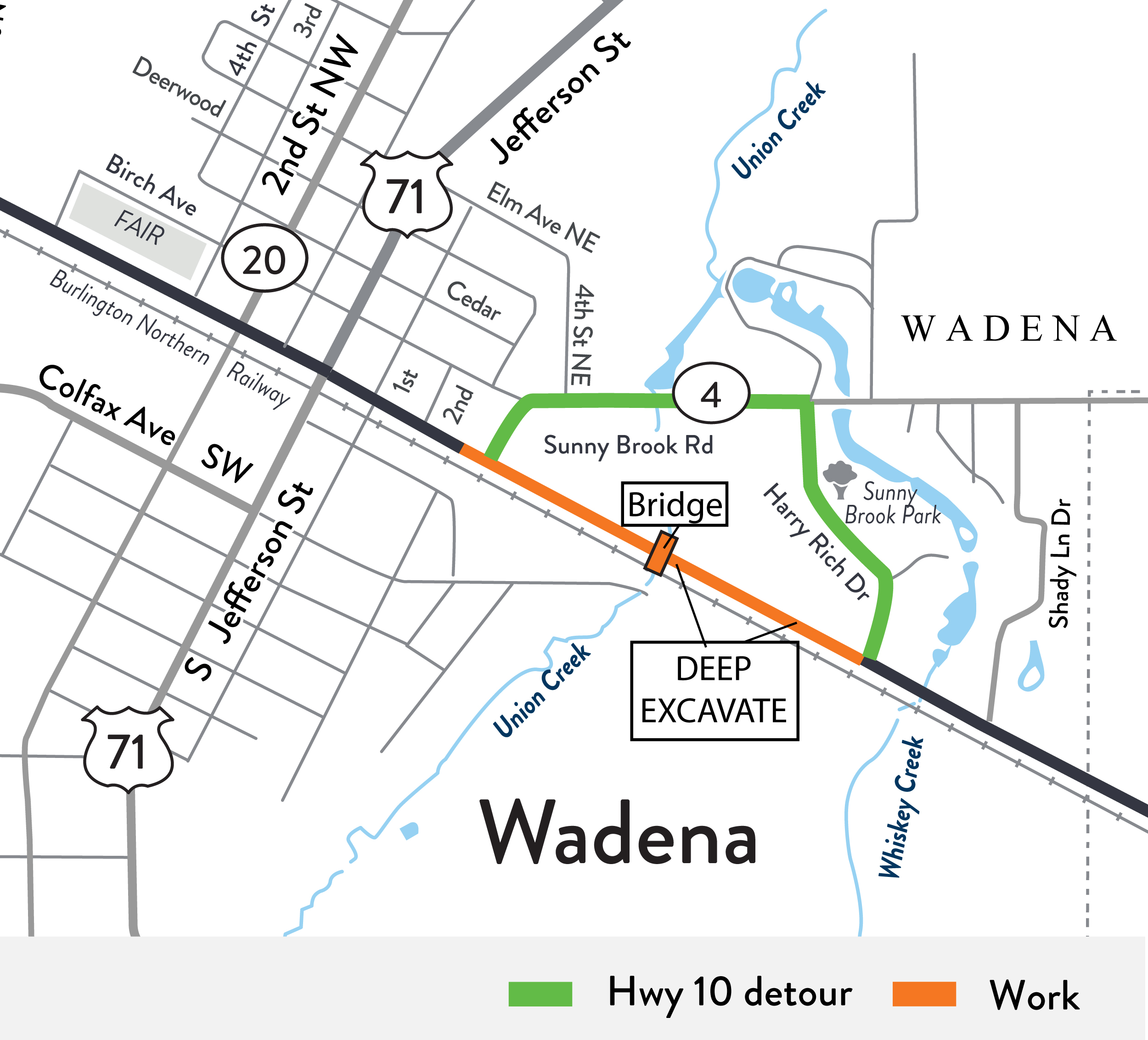
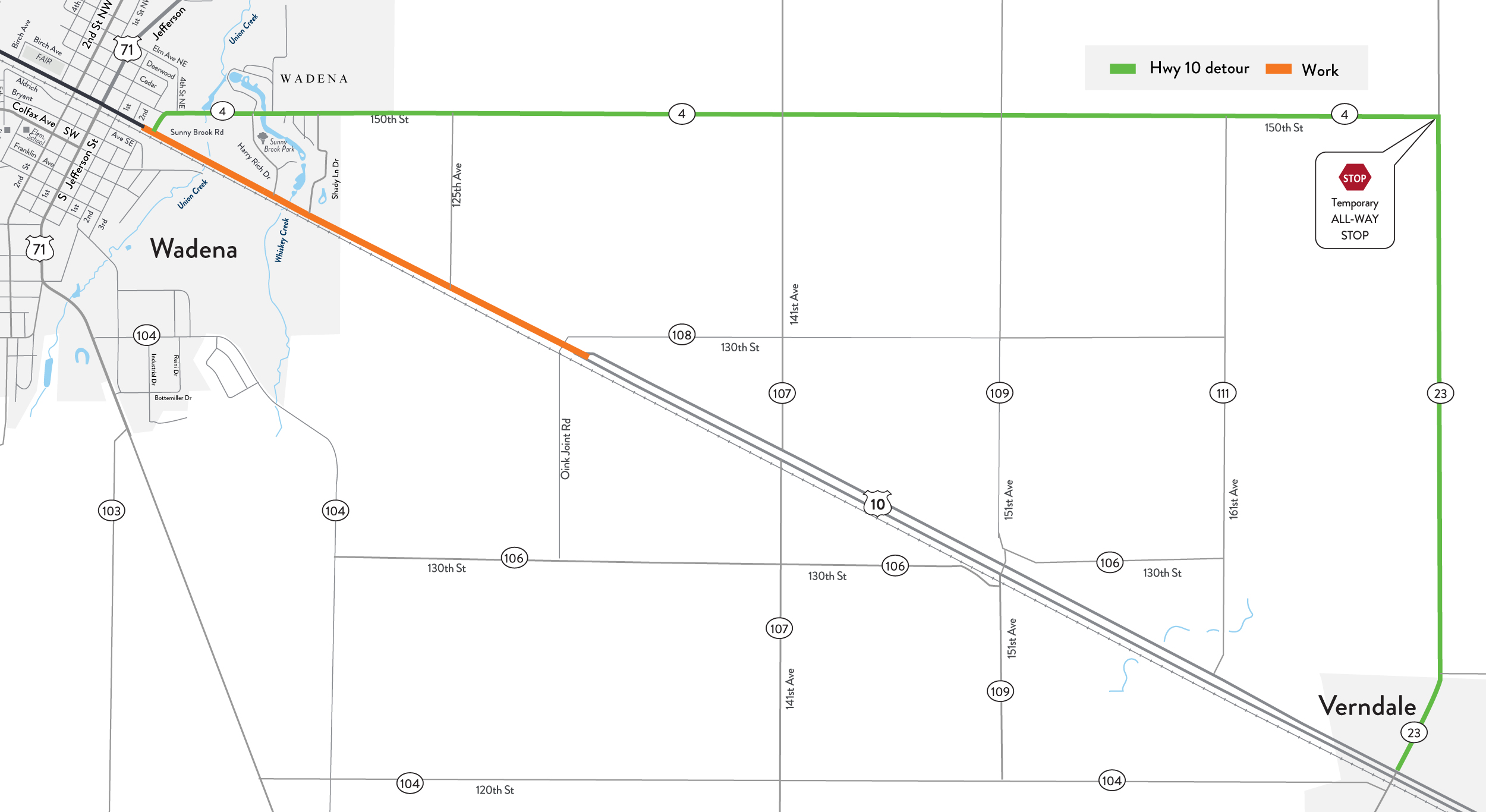
Detours are necessary at times to complete work: Hwy 10
|
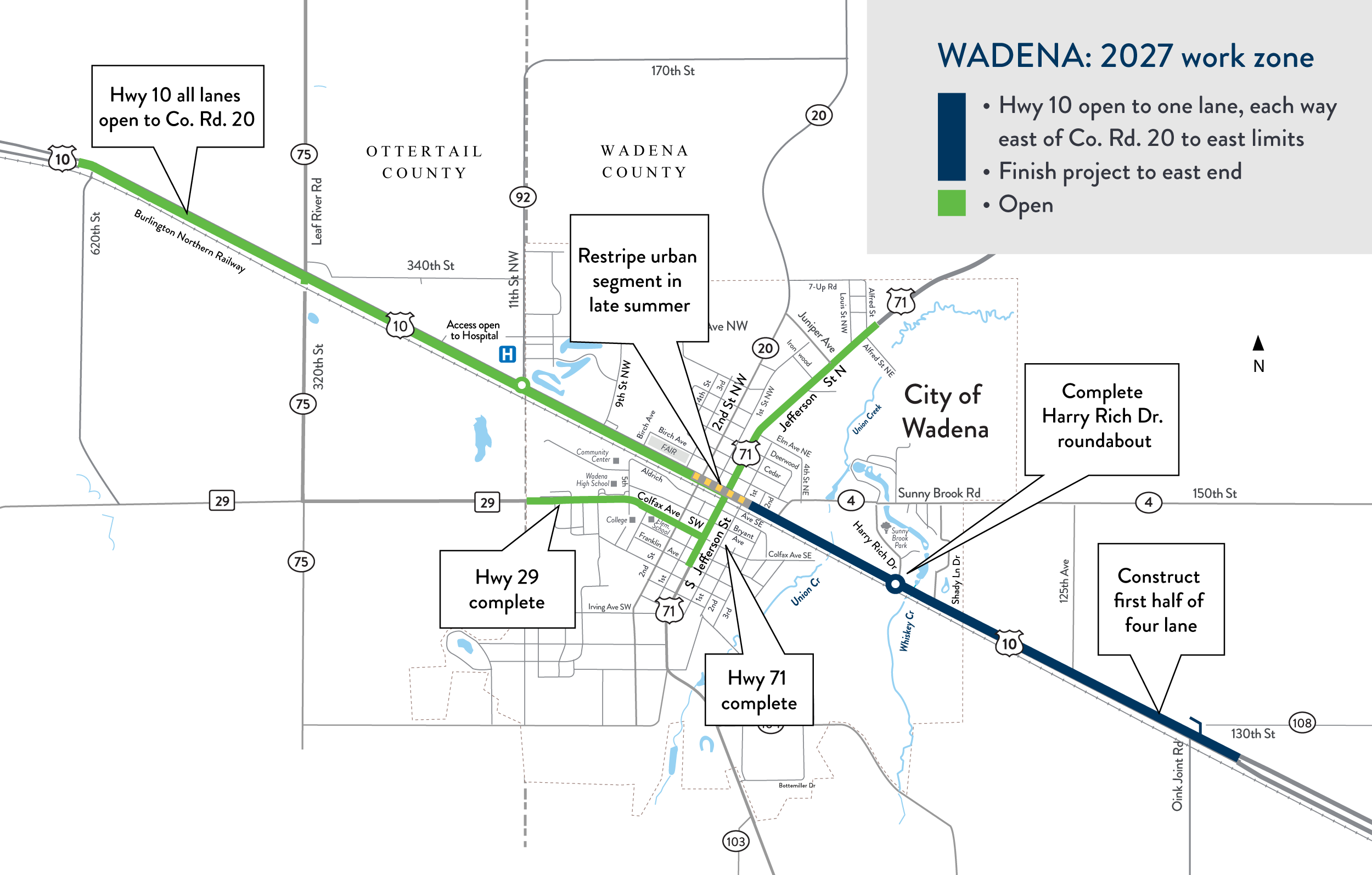
April-August 2027 |
Dark blue |
Hwy 10 - east of Co. Rd. 20 to Oink Joint Rd.
|
Hwy 10 Open one lane, each way
|
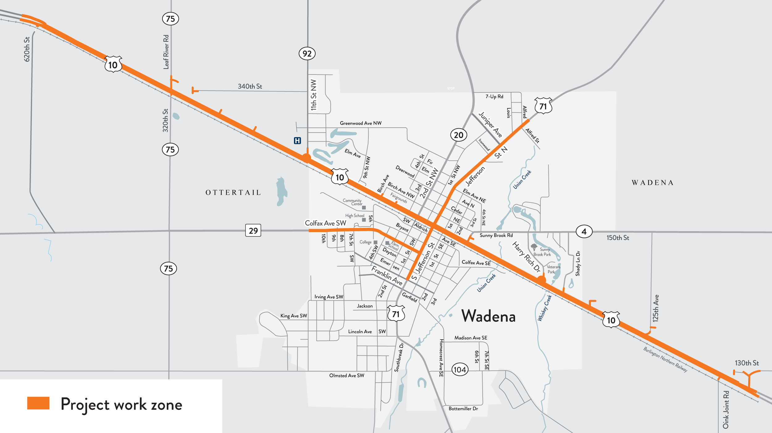
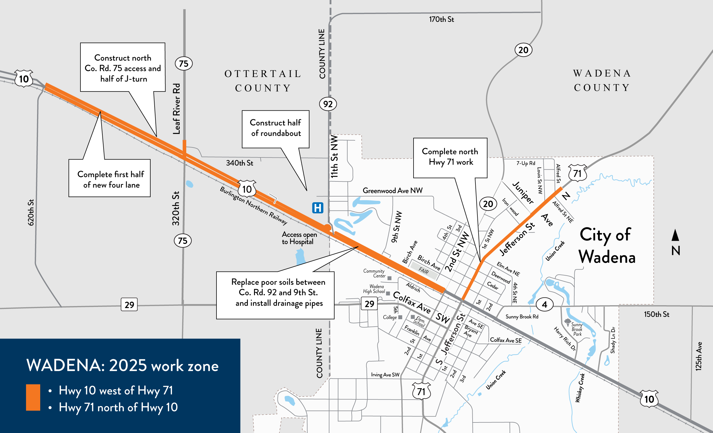
June-November 2025 |
Orange COMPLETE |
2025 work areas map (PNG)
|
Complete |